Claire Fitzgerald: Mapsphere

Your name?
Claire Fitzgerald
Your job title?
Director at Mapsphere
What are your main tasks/responsibilities as GIS/data analytics specialist?
Analysing spatial data is only one element of my work. This stage will often happen mid project, after the project concept and plan has been developed and when the spatial data has been sourced (e.g. raster data from an Earth Observation satellite e.g. ESA Sentinel satellites, vector sea surface temperature data, meteorological data transmitted from ships at sea, moored and drifting buoys and collected by satellites e.g. the EUMETSAT satellite which collects weather and climate data from space). Once all of the project inputs are compiled specialist software packages are used to ingest the datasets and ensure they all layer correctly using their geographic coordinates, after which geostatistical analyses are carried out and models scripted and run to enhance and analyse the data in order to extract meaningful information.
How do you use mathematics in your job?
For remote sensing maths physics, calculus and statistics are used when looking at electromagnetic radiation and its interaction at different wavelengths with the atmosphere and surface. Working in remote sensing also requires knowledge of the sensor technology and data acquisition systems of the primary remote sensing platforms. For Geographic Information Systems (GIS) when creating maps a map projection is necessary. This is a systematic transformation of the latitudes and longitudes of locations on the surface of a sphere or an ellipsoid into locations on a plane using linear algebra, differential geometry and projective geometry – put simply a conversion between two sets of values. Properties such as Area, Shape, Direction, Bearing, Distance and Scale can be measured on the Earth’s surface independent of its geography and map projections are constructed to preserve at least one of these properties, with each projection compromising basic metric properties in different ways. The purpose of the map will decide which projection to be used. Beyond map creation mathematics through modelling and geostatistical analyses of spatial data are also used.
What type of mathematics do you use to solve problems?
Statistics – a basic statistical way of thinking is essential for problem solving and decision making. All spatial data are ultimately derived from measurements and heavily processed afterwards, both of which can introduce errors that can only be treated as random. This randomness needs to be understood and modelled, to learn how to control it when possible and how to measure it and respond to it in any case.
Calculus is used when we need to optimize something i.e. find the best route, find the best corridor, the best view, etc. and to calculate lengths, areas, and volumes.
Maths Physics is used to calculate the period and orbiting radius of a Geosynchronous Satellite around the Earth – when a satellite travels in an orbital period the same as the Earth’s rotation period it needs to travel at a certain orbiting radius and period to maintain this orbit. Because the radius and period are related, you can use physics to calculate one if you know the other.
Geometry is used, both spherical geometry and the study of groups of transformations of objects. This is the unifying concept to moving objects around on the earth or on the map.
Differential geometry is used to investigate smooth curves and surfaces e.g. wide-area land surveys, and helps to understand geodesy, curvature, topographic shapes etc.
Topology is used to describe and calculate with the vector representations of lines, curves, and polygons.
Numerical analysis is useful when solving computing issues due to running into limits of precision and accuracy which can cause procedures to take a long time to execute, or to not compute at all, and can result in wrong answers.
Discrete mathematics includes some basic graph theory, design of data structures, algorithms, and recursion, as well as a study of complexity theory.
What aspects of the mathematics curriculum or mathematics courses have proven most useful to you?
Calculus, Algebra, Discrete Mathematics, Statistics and Physics.
What is your education to date?
I have over 12 years of international work experience in the fields of GIS and satellite based Remote Sensing. My educational path to this point started with choosing Honours Mathematics, Physics and Geography amongst the subjects I studied for my Leaving Certificate. These subjects provided a great base for my Marine Science Degree at NUI Galway. After 4 years studying Oceanography, Mathematics, Statistics, Geology and the biological subjects of Marine Science, I received my BSc Hons in Marine Science. As part of my final year of studies at NUIG I chose Physical Oceanography (the exploration and study of the physics and geography of the ocean currents and water properties) as my specialist subject and was set an essay topic on ‘The use of Remote Sensing in Physical Oceanography’. Remote Sensing is the scanning of the earth by satellite or high-flying aircraft in order to obtain information about it. This essay sparked my continuing interest and work in satellite Remote Sensing, beginning with my MSc in Geographic Information Systems & Remote Sensing from NUI Maynooth. I have also completed training courses for various mathematically based spatial software’s to continue my education in spatial data analytics, GIS and remote sensing.
What advice would you give someone considering your job?
A spatial data analyst thinks outside of the box. As the underlying concepts of this field are mathematics, spatial data analysts can have backgrounds in maths, statistics, geology and even astrophysics – studying subjects such as Maths, Applied Maths and Physics at second level will help enormously in any third level courses in these areas, in fact they are prerequisites for some. Working in GIS and Remote Sensing requires solid knowledge of computer based technology – if you have an aptitude for this and are genuinely excited and enthusiastic about learning and pushing technical limits and finding solutions then this is a great career option. Yes, programming skills are of great benefit but understanding of mathematics and statistical analyses is key to success in this field. In the advent of Big Data we need more and more people with the curiosity and skills to work with and extract meaningful information from these enormous datasets – being a Data Scientist has become one of the coolest job of the 21st century! Just 7 years after the job title was coined thousands of data scientists are already working at both start-ups and well-established companies. Why? Well we are now wrestling with information that comes in varieties and volumes never encountered before – for example ESA’s Sentinel 2-A satellite will acquire, store and then have to transmit 1.6 terabytes of data per orbit alone. These data will be transmitted to ground stations that will store multiple petabytes of data, leaving critical decision making information buried within rows and columns of numbers to be mined by data scientists, possibly you!
What do you find most interesting in your job and what do you find are the main challenges?
I have had the opportunity to travel to some fantastic places to further work on applications such as remote sensing for mangroves in West Africa and Central America, and coral reef monitoring programmes in the Indian Ocean. Working on the International Disaster Charter for Space and Major Disasters allowed me to be part of an international consortium of Space Agencies who used satellite Earth Observation data to respond in near real time in times of natural disasters – this was more than just interesting, it was also truly rewarding to be part of such an initiative. I think my biggest challenge is putting the cool data and tools down and focusing on the administration tasks that come with each and every role you have.
Biography
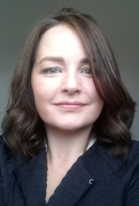
Claire is Director of Mapsphere Limited, a Geospatial consultancy which provides professional support to existing and new users of remotely sensed data with a particular focus on Earth Observation applications and downstream services. She has over 12 years of international experience at the commercial, government and research sector interface having held strategic positions within all three domains, most recently operating at senior management level in a global premier Geospatial company within the Space and Defence sector. A Fellow of the Royal Geographical Society, her experience serving as an Executive Member of the British Association of Remote Sensing Companies, as the UK Executive Secretariat for the International Charter for Space and Major Disasters liaising directly with the UK Cabinet Office, and over 4 years working for the United Nations Environment Programme results in the provision of a unique insight into the complex world of satellite Earth Observation.


